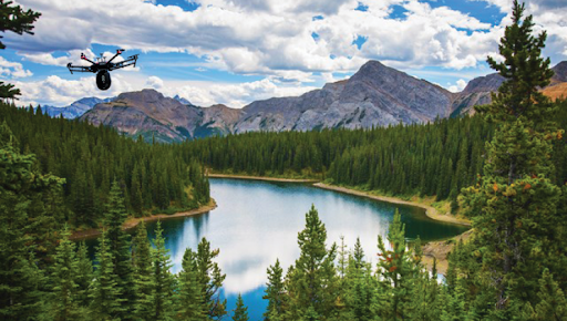
How Drones are Helping Save the Planet
More Than Just a Toy
Everybody knows somebody who got a drone for Christmas, right?
I remember when my younger brother received one as a present, he was ecstatic and couldn’t wait to try it out. Unfortunately, his enthusiasm was short-lived as he accidentally flew it into the tallest tree in our yard, where it remains stuck to this day, almost five years later.
Despite their reputation as mere toys or videography tools, drones have proven to be incredibly valuable in the fields of ecology and environmentalism. These unmanned aerial vehicles can provide scientists and experts with a bird’s eye view of landscapes and wildlife, allowing for more accurate data collection and analysis. They can also be used for tasks such as monitoring deforestation, tracking animal migrations, and even detecting environmental hazards. Overall, drones have become an indispensable tool for those working to protect and preserve our planet.
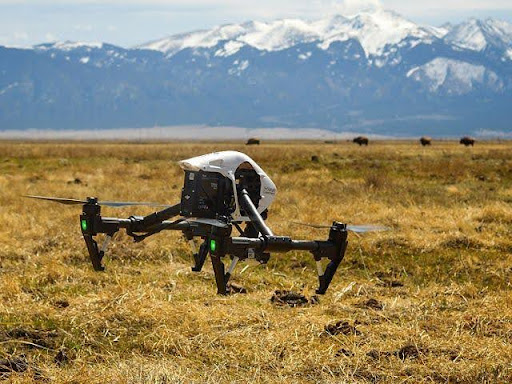
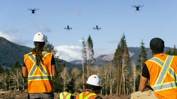
Drones can be remotely operated to patrol areas that are difficult to access on foot
Efficiency in Wildlife Monitoring
Wildlife conservation research is an arduous task that often involves physically demanding work. Scientists are required to travel long distances, even through remote areas, to monitor population and resources. This can be extremely time-consuming and tiring, which is where drones come into play. These unmanned aerial vehicles can be remotely operated to patrol areas that are difficult to access on foot, making the process much easier and more efficient. Moreover, drones can be employed to reduce the risk to researchers when monitoring projects that are focused on dangerous species. For instance, scientists in Australia use drones to remotely track shark populations (Gorkin et al., 2020), something that would otherwise be much more perilous and risky if done in person.
The Countless Advantages of Drones in the Field.
Drones are capable of reducing the impacts of research on focus species. The Colorado branch of The Nature Conservancy uses drones equipped with infrared and nocturnal cameras to track migratory bobolinks, a task that is usually impossible to perform without adverse effects for the species. Conservation scientist Gustavo Lozada claims that traditional research methods led to nest disturbance and created paths for predators, but using thermal imaging via drone reduces negative impacts and is equally as effective (Davis, 2021).
Drones are now being flown in areas where poachers are thought to operate and are able to immediately report poacher locations to local park rangers. -Caitlin Fullam, The Nature Conservancy
Collecting aerial imagery can provide data that may not be available in ground-research techniques. Animal poaching plagues rare and treasured species, and catching poachers on foot proves difficult due to the advanced technology they use. Drones are now being flown in areas where poachers are thought to operate and are able to immediately report poacher locations to local park rangers, who then mobilize to these areas directly rather than patrolling entire territories (Daly 2021).
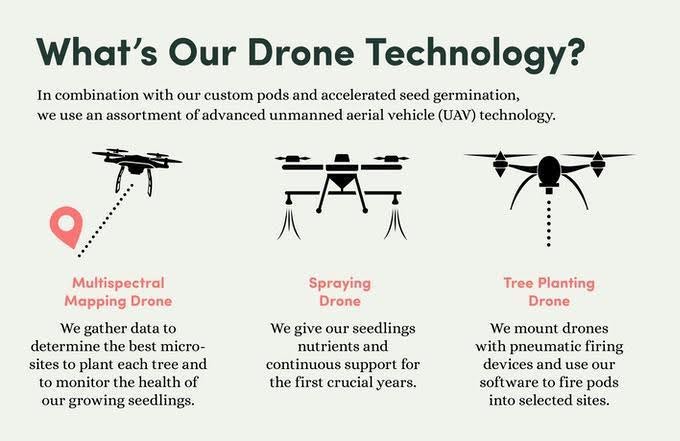
While drones have streamlined and improved conservation efforts, they are also being used to replenish habitats. Companies such as Mast have designed machines to reforest areas that were previously disturbed. This process is six times faster than a normal planting crew, and it even includes ghost peppers in dropped capsules to keep rodents from eating the seeds (Shore, 2020).
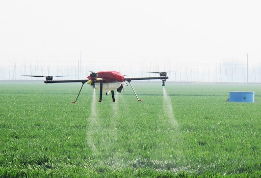
Drone spray technology is an efficient and increasingly popular smart farming technique for precisely applying fertilizers to crops
Drones have also helped plant trees.
Jimmy Donaldson, widely known as YouTube philanthropist MrBeast, partnered with Mast reforestation (formerly Droneseed), for a reforestation campaign in celebration of reaching 20 million subscribers. For every $1 donated, Donaldson and Mast pledged to plant one tree (Shore, 2020). Thanks to the efficiency of drone-based seeding, the campaign has already resulted in the planting of 23.5 million trees (TeamTrees, 2021).
Drones are also becoming an invaluable resource in sustainable energy and land management. Monitoring renewable energy sources like solar panels and wind turbines traditionally requires significant time, manpower, equipment, and fuel. By utilizing camera drones, energy companies can streamline inspections, cutting both costs and carbon emissions while improving efficiency.
Land management often relies on aerial imagery to create accurate maps and assess how development will impact an area. Drones offer a fast, efficient alternative for mapping that doesn’t require on-site teams, and their high precision can surpass traditional aerial methods (senseFly, 2021).
How else can drones help scientists?
Drones can perform many tasks that once required foot access or expensive aerial surveys by planes or helicopters. In fact, the cost of a single manned helicopter survey can equal that of a research drone, which can be used for thousands of surveys (senseFly, 2021). Additionally, drones are less invasive than traditional aircraft and can fly closer to the ground, providing more detailed and accurate data without disturbing the environment.
Drones can replace costly helicopter surveys, offering a more affordable option for thousands of surveys.
Drones are saving researchers and conservation groups valuable time, effort, and money. By making previously unfeasible projects possible, they are playing a crucial role in advancing our understanding of and efforts to protect the natural world. While often seen as trendy gadgets or camera tools, drones are quickly becoming an indispensable asset in conservation and environmental work.
Limitations and Potential Policy Changes
While drones are revolutionizing wildlife monitoring and conservation, there are limitations that need to be addressed. One major restriction is the line-of-sight rule for drone operations. This means that drone operators must maintain visual contact with the drone, which can be a challenge in remote, rugged, or wilderness areas. Biologists often still need to travel to these areas to conduct surveys, saving only the physical effort of hiking but not eliminating the need for travel. Currently, only a few companies hold special permits for unmanned operations beyond visual line of sight (BVLOS). A policy change that could help is the expansion of BVLOS permits for environmental surveying. This would allow researchers to perform surveys over large, remote areas without needing to be physically present, increasing efficiency and extending the capabilities of drone technology in conservation and land management efforts.
– Written by Katelyn Hammel, SummitWest Biologist